Wolola Gold Project
21.4756 km² on the Birimian belt
The Wolola project covers 21.4756 km² at Balandougouba, Mandiana Prefecture, Kankan Region, in Guinea's northeast. The permit lies within the Siguiri Basin on the Birimian Greenstone Belt, about 70 km southeast of Siguiri town. The basin hosts the region's major gold producers. Artisanal workings across the licence area show an active gold system at surface.
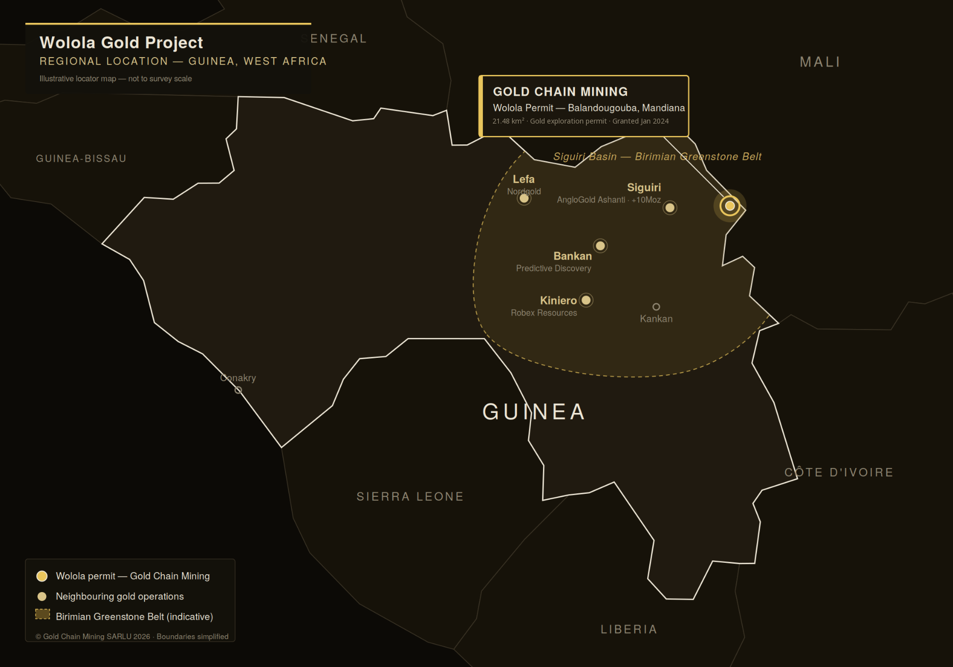
The permit
- Instrument
- ARRÊTÉ A/2024/006/MMG/SGG
- Granted by
- Ministère des Mines et de la Géologie, Republic of Guinea
- Granted
- 10 JAN 2024
- Cadastre No.
- 23425
- Area
- 21.4756 KM²
- Location
- Balandougouba, Mandiana Prefecture, Kankan Region
- Holder
- Gold Chain Mining SARLU
The core-tray timeline
Soil geochemistry & IP survey
72 soil samples were assayed by SGS, with a peak result of 20.83 g/t Au. A ground induced polarisation (IP) survey by CGS defined five chargeability anomalies, including two priority targets: GCM_S1 and GCM_S2.
Diamond core & reverse circulation
14 holes for 1,585 m: nine reverse circulation (RC) holes for 1,080 m and five diamond core (DD) holes for 505 m. All holes were drilled in the East Zone and sampled at 1 m intervals.
Bedrock gold confirmed
The best intercept is 4.0 m at 1.86 g/t Au from 72 m in RC hole OL6-3, including 1 m at 3.29 g/t Au. Diamond hole P3A returned 2.0 m at 1.00 g/t Au from 18 m. The OL6-3 intercept sits in partly weathered to fresh bedrock, which points to a bedrock source.
Key results
Downhole widths. True widths will be confirmed in Phase 2. Results are raw laboratory values and are not yet independently audited. No mineral resource has been declared.
Next steps
Phase I drilling covered one corridor in the East Zone – a small part of the permit. The Western Zone is untested. Gold Chain Mining is seeking a technical partner for Phase 2.
- In-fill RC and diamond drilling around OL6-3
- First drill test of IP targets GCM_S1 and GCM_S2 in the Central Zone
- About 2,400 soil samples across the Western and Central zones
- Independent audit of the Phase I assay data